Export Map Data
Quick Summary
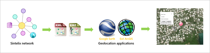
The Network nodes that contain geographical coordinates (latitude and longitude) can be exported as KML Keyhole markup Language, an XML notation for expressing geographic annotation and visualization within two-dimensional maps and three-dimensional Earth browsers such as Google Earth. and KMZ Keyhole markup Zip, a file format used to compress and distribute kml files. files which can then be uploaded to the geolocation applications such as Google Earth An application that renders a 3D representation of Earth based on satellite imagery. Sintelix can export geographical data from networks, which can then be uploaded to Google Earth. and Esri ArcGIS.
The following illustration explains the export process:
What you can do
You can:
- Export images and coordinates.
- Specify the fields and features to be exported.
- Save and load preset export settings.
Configurations
From Configurations > Geodata Export Presets you can copy and export preset export settings (Geodata Export Presets).
Ways to export
To export geodata, select the:
-
Export button
 when viewing a map, or
 -
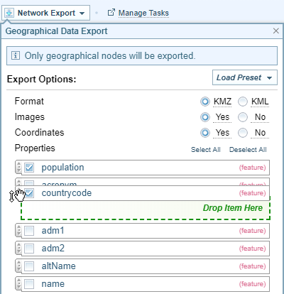
Network Export dropdown from the network menu and selecting Export Geodata.
Result: The Export Options dialog is displayed.
Export Options Dialog
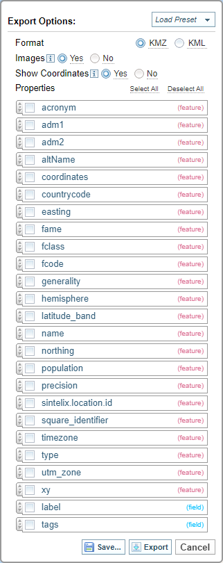
Note: You can click and drag the field lines to change the order of the features.
Export Options
You can:
-
Select the Load Preset dropdown option
 to select from previously saved Export options, and select the Export button to download the requested file.
 -
Select the required options and properties, and select the Export button
 to download the requested file.
 -
Select the required options and properties, and select the Save button
 to save the Export options for use in the future.
 Only a Configurer can save the settings.
When you select save, the Save GeoData Export Preset As dialog is displayed.
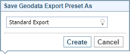
Enter a name, and select Create.
These export options will now be available from the Load Preset dropdown.